Venus Line Spectacular View Driving Guide
One of Japan's best highland panorama roadsArea B:
Shirakaba Kogen ~ Kurumayama Kogen ~ Kirigamine
See larger map of Venus Line Driving Guide
Shirakaba Lake (Altitude: 1416m)
This artificial lake was created in 1946 to secure water for agriculture.
It was formerly a wetland called Ikenodaira.
The lake covers an area of about 36 hectares and has a circumference of about 3.8 km.
There are large resort hotels, inns, pensions, and guest houses along the lakeside, and boats are available for sightseeing.
A ski resort and golf course are located nearby, making it one of the best resort areas in Nagano Prefecture, and there is also an amusement park that is open from mid-April to late October, attracting families during this period.
[Contacts]
TEL:+81-(0)266-72-2637
Chino City Tourist Information Center

Kurumayama Mountain Lift
(Altitude lift station: 1566m / Summit of Kurumayama: 1925m)
Kurumayama, the main peak of Kirigamine, one of the 100 most famous mountains in Japan, can be reached near the summit using the lifts at Kurumayama Kogen Ski Resort.
It takes about 15 minutes to reach the summit of Kurumayama (1,925 meters above sea level), which offers one of the best views in Japan, by taking two lifts with a capacity of 4 persons.
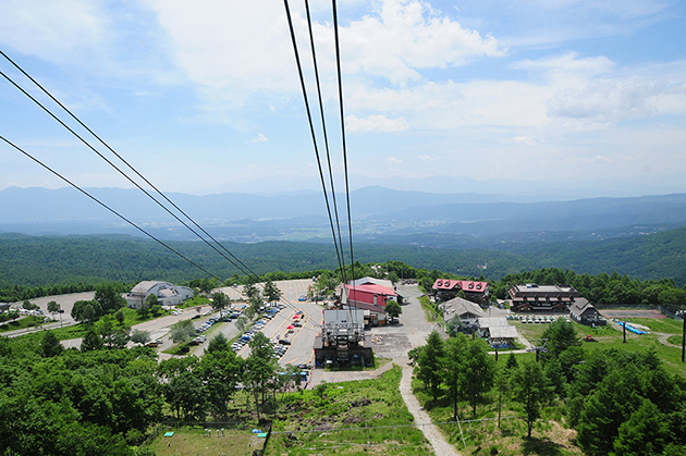
On the way up, you can enjoy the top of Kurumayama and the scenery of the plateau, and on the way down, you can enjoy the magnificent panoramic view of Mt. Tateshina and Lake Shirakaba.
From the summit of Kurumayama, you can see the Yatsugatake mountain range nearby, and if the weather is good, you can even see Mt. Fuji, the Southern Alps, the Central Alps, the Northern Alps, and the Asama mountain range.
From the summit (1925m), there is a trekking course (4.2km/80min.) to Kirigamine (1698m) via Kirigamine-shoulder (1817m), or an approach course (5.2km/80min.) from the summit to Chouchoumiyama (1836m), Monomiishi (1780m), and Yashimagahara Wetland (1647m). (5.5 km / 120 min.).
The gently sloping grasslands offer good views and a variety of alpine flora blooms depending on the season.
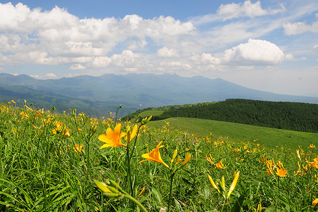
The Nikkoukisuge (Daylily) in July is especially popular.

Entrance to the Kurumayama Mountain Lift - Large parking lot is available nearby, and restaurants and stores are also large-scale

Mt.Tateshina and Shirakaba Lake can be seen below

On clear days, the summit of Kurumayama offers a panoramic view in all directions

Kurumayama Shrine at the summit

Mt.Ontake (3067m) and Kirigamine (1698m) seen from the summit of Kurumayama

Mt.Tateshina (2530m) and Lake Shirakaba (1416m) seen from the summit of Kurumayama

Kurumayama Weather Radar Station at the summit
At the summit of Kurumayama is an unique building with a globe on its roof, the Kurumayama Weather Radar Station, which was established by the Japan Meteorological Agency in 1999.
Inside the globe at the top of the building is a parabolic antenna with a diameter of 4 meters, which emits radio waves while rotating to observe the strength and movement of rain and snow over a wide area.
Kurumayama Mountain Lift (foot to summit, Sky Panorama transfer) is 1,600 yen round-trip for adults (1,000 yen for elementary school students/500 yen for infants) and 1,000 yen one-way (600 yen for elementary school students/300 yen for infants). The service is available from late April to early November.
Kirigamine Fujimidai Restaurant (Altitude: 1702m)
Located almost halfway between Kurumayama Mountain Lift (Kurumayama Kogen Ski Resort) and Kirigamine (Kirino Station) on the Venus Line, it is a viewpoint from which you can see the Yatsugatake mountain range, Mt Fuji, the Southern Alps, and the Central Alps.
The view, which changes its face depending on the season, is breathtaking.
In spring, the snow melts and buds begin to sprout; in summer, azaleas and Nikkoukisuge bloom; in autumn, the leaves turn a spectacular red; and in winter, a majestic silver world can be enjoyed.
Especially in summer, a walking trail is maintained on the slope of the hill across the road, where camera fans are constantly taking pictures of the alpine flora.
The restaurant, which is open every day during the summer, offers its famous "Kirigakure Soba/Udon" (720 yen) and other dishes.
Other popular dishes include Shinshu gohei-mochi (320 yen), Shinshu oyaki (260 yen), Soba dango (450 yen), and soft-serve ice cream (350 yen).
There is also a souvenir store with a full lineup of souvenirs.

Kirigamine Fujimidai Restaurant

Mountain guide in the parking lot - If conditions are good, a large panorama is right in front of you!

Nikkoukisuge (Daylily) and Mt. Yatsugatake

Nikkoukisuge (Daylily) and Mt. Tateshina

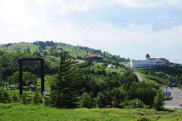
Venus Line, From Kirigamine Fujimidai Restaurant to Restaurant Chaplin

Venus Line, a comfy highland drive - From Restaurant Chaplin to Kirino Station

Venus Line, with a panoramic view of the Japanese Alps - From Restaurant Chaplin to Kirino Station
[Contacts] TEL:+81-(0)266-68-2586 Kirigamine Fujimidai Restaurant
Restaurant Chaplin (Altitude 1820m)
The restaurant is located on the Kurumayama Shoulder.
From the restaurant, you can enjoy a panoramic view of the Southern and Central Alps.
Sauce katsu-don (pork cutlet served on top of a bowl of rice) and katsu curry are popular.
[Contacts] TEL:+81-(0)266-58-7275

Restaurant Chaplin
Kirino Station and Kirigamine Venus (Altitude: 1674m)

A drive-in at Kirigamine Kogen, located at the crossing of the Venus Line connecting Kurumayama to the Utsukushigahara Plateau.
On the right is Kirino Station, and in front is Kirigamine Venus. Both are restaurants with souvenir shops.
[Contacts]
TEL:+81-(0)266-54-6370 Kirino Station
TEL:+81-(0)266-52-7863 Kirigamine Venus
Kirigamine Horse Riding Club (Altitude: 1674m)

Located on the south side of Kirigamine Kogen and Kirino Station, this horse riding course boasts the highest altitude in Japan.
You can enjoy a 5 minute horseback ride for 1,000 yen, accompanied by a staff member. There is a glider runway to the south of the riding course.


